The Shattering Arctic
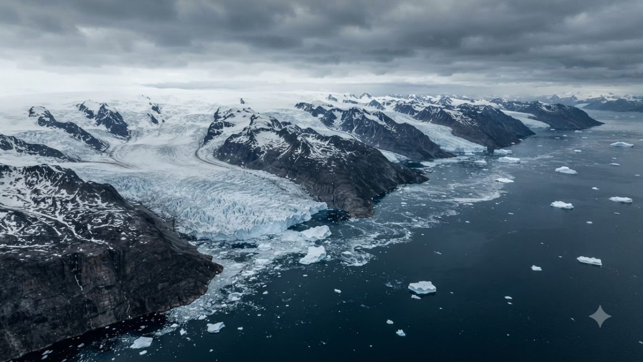
High above the jagged, desolate coastline of Northwest Greenland, the silence of the Arctic was violently interrupted in the second week of August 2026. Miles of ancient, crystalline ice, held in place for decades by the cold inertia of the Nares Strait, finally surrendered. Sentinel-1, an advanced radar imaging satellite orbiting hundreds of miles overhead, captured the precise, chilling moment that the Petermann Glacier—a titan of the north—began to shed a portion of its massive floating tongue. The resulting rupture created an ice island of startling proportions: a slab of frozen freshwater roughly the size of Manhattan, adrift now in the dark, frigid waters of the fjord.
To see it from orbit is to witness a geologic event stripped of its usual slow-motion mask. It is a sudden, stark realization of scale, where the frozen monuments we once assumed were permanent fixtures of the landscape are revealed, instead, to be fragile and fleeting. Understanding a loss of this magnitude requires us to move past the sheer visuals and look at the geometry of the collapse, tracing the rift lines that spider-webbed across the glacier’s surface long before the final, thunderous break occurred. The anatomy of this specific event began to take shape in the early days of August 2026.
While the world generally views glaciers as slow-moving rivers of ice, the Petermann Glacier operates with a volatile, hidden rhythm.
Anatomy of the 2026 Break
By August 10, satellite telemetry indicated that the structural integrity of the floating ice tongue had reached a critical threshold. The stress, which had been accumulating internally for years, manifested in a widening fissure that spanned nearly the entire width of the glacier’s northern reach. By August 12, the detachment was confirmed. Media outlets, including Gizmodo and FOX Weather, broadcast images of the massive, independent ice island drifting away from the glacial front, forever altering the geography of the fjord. This was not merely a random splintering of ice; it was a major calving event.
While calving is the natural biological process of a glacier, the frequency and scale of these breaks serve as a diagnostic indicator for the entire system’s health. The Petermann Glacier’s floating ice tongue serves as a vital structural dam, holding back the immense, pressurized weight of the land-based ice sheet behind it. When a section this large breaks away, that natural barrier is diminished, leaving the glacier’s grounding line—the point where the ice leaves the bedrock and begins to float—exposed to new, unchecked forces. This event forces us to ask: what was the Petermann Glacier, and how did it arrive at this state of chronic instability?
To understand the gravity of the 2026 break, one must look at the history of this giant in Northwest Greenland. Throughout the 20th century, the Petermann Glacier’s floating tongue stretched far out into the Nares Strait like a massive, frozen bridge, acting as a sentinel of the high Arctic. However, the last two decades have been a period of rapid contraction. This recent calving echoes the major structural losses of 2010 and 2012, both of which produced gargantuan ice islands that drew the eyes of the global scientific community.
The Giant of Northwest Greenland
During those years, the glacier’s edge retreated by kilometers, marking a fundamental shift in the regional glaciology of the Nares Strait. The grounding line, the precise boundary where the ice sheet loses contact with the sea floor and begins its journey into the ocean, has been the subject of intense, obsessive monitoring by researchers for decades. Scientists have watched as the glacier’s retreat sparked alarms regarding the long-term stability of the northwest Greenland ice sheet. This is not a static environment; it is a landscape in active, accelerated decay.
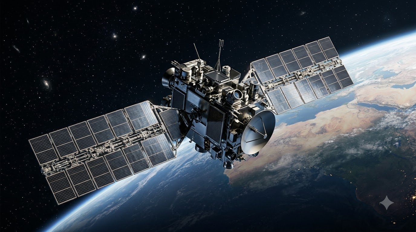
The patterns observed in 2010 and 2012 were the harbingers of this modern crisis, showing that once a glacial front is compromised, the stability of the entire region becomes increasingly precarious. But how do we track these remote, frozen expanses in such detail? The answer lies in the evolution of our reach into the dark, overcast corners of the planet. Monitoring such a remote and extreme environment requires specialized technology, especially since the Arctic is plagued by near-constant cloud cover and long, sunless polar nights that render standard cameras useless. The Sentinel-1 mission has become the indispensable eyes of the modern glaciologist.
Unlike optical satellites, which rely on visible light to capture imagery, Sentinel-1 utilizes Synthetic Aperture Radar, or SAR. This technology works by emitting microwave pulses toward the Earth and measuring the reflection—or backscatter—that returns to the sensor. Because these microwaves can easily penetrate thick clouds, fog, and the impenetrable darkness of the winter months, they allow scientists to map the Earth’s surface with high spatial resolution regardless of the weather. SAR is sensitive enough to differentiate between types of ice, identifying structural anomalies, shear zones, and the subtle, creeping expansion of crevasses that might otherwise go unnoticed for years.
Eyes in the Dark: Sentinel-1 Synthetic Aperture Radar
For the scientists managing the Petermann monitoring program, this continuous radar feed is the only way to maintain a comprehensive, real-time record of the glacier’s behavior. By analyzing the wave patterns returning from the ice, researchers can reconstruct the physical stress of the glacier, tracking the movement of rifts as they propagate from the outer margins inward. It is this high-resolution data that allowed us to deconstruct the lead-up to the August 2026 collapse, turning a sudden event into a visible timeline of mounting tectonic pressure. The satellite record of the 2026 event provides a chillingly clear trajectory of the structural failure.
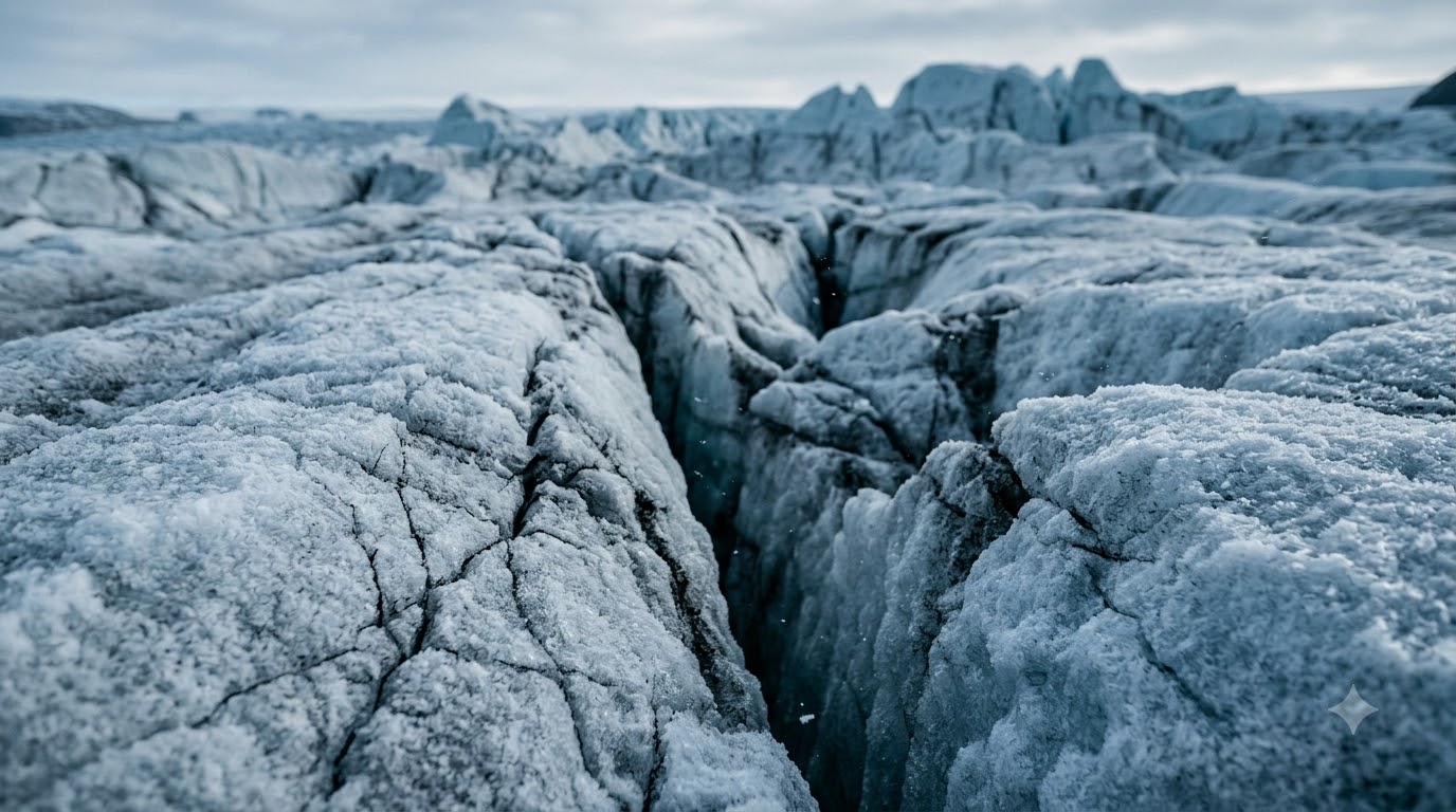
Long before the final collapse in August, Sentinel-1 imagery began to isolate distinct, linear features running perpendicular to the flow of the ice tongue. These are rifts—massive, deep-seated fractures that penetrate the entire vertical thickness of the floating ice. Glacial rifts are not merely superficial cracks; they are the fatal flaws of a glacier. As the ice tongue is pushed seaward by the massive pressure of the land-based glacier behind it, the ice encounters lateral friction against the fjord walls and bedrock obstacles below. This mechanical stress causes the glacier to spread laterally, stretching the ice until it can no longer maintain its structural cohesion.
Over several months, these rifts were seen propagating from the outer margins toward the center of the tongue. By mid-July 2026, the radar data showed the rifts deepening and widening significantly, creating an unstable wedge of ice that was effectively hanging on by a thread. The imagery captured in the days leading up to the August 10th milestone documented a critical propagation phase where multiple rifts began to coalesce. This is the moment a glaciologist fears—when the localized damage integrates into a regional failure. Seeing this progression in such granular detail allows researchers to understand the calving not as an isolated accident, but as the culmination of long-term cumulative stress.
Deconstructing the Satellite Record
Once these rifts finally reached the central axis, the mechanical integrity of the tongue shattered, resulting in the clean, dramatic separation of a Manhattan-sized ice island that immediately drifted into the fjord. This newly calved giant does not simply vanish. Once detached, the ice island becomes a drifting, dynamic hazard, moving with the complex circulation patterns of the Nares Strait. Its journey is dictated by the interplay between regional wind stress and the deep-seated currents of the Arctic. As this massive, multi-billion-ton structure drifts southward into Baffin Bay and toward the Labrador Sea, it initiates a series of profound environmental disturbances.
The most immediate is the injection of immense volumes of cold, fresh meltwater into the local marine environment. As the ice island warms, it sheds its glacial cargo, altering the local salinity and temperature profiles of the water column. For marine ecosystems, this influx is a significant stressor, potentially disrupting the stratification of the water and the delicate biological rhythms of local fauna. Beyond the ecological impact, these floating islands represent a severe, unpredictable threat to navigation.
Given the scale of the 2026 ice island—comparable in surface area to the densely packed geography of Manhattan—it possesses enough mass and momentum to crush any vessel that crosses its path or disrupt the operation of offshore infrastructure. These drifting ice giants complicate the logistics of shipping lanes that were already seeing increased activity due to receding sea ice, turning the Nares Strait into a high-risk zone for maritime operations. Yet, for all our sophisticated imaging, the scientific community is still grappling with significant predictive limitations. While we can now track the lifecycle of a rift with near-perfect clarity, the exact moment of failure remains elusive.
Scientists can observe a rift for months, seeing it pulse and grow, but predicting the ‘hour of the break’ is a task that computational models struggle to execute with precision. This is largely because ice is a complex, non-linear material.
Drifting Giants: Fjord Dynamics and Ocean Currents
Its strength and behavior are governed by microscopic fracture dynamics and internal temperature variations that are incredibly difficult to scale up to the size of a multi-kilometer ice tongue. Current models account for air temperatures and surface conditions, but they often fail to capture the subtle, internal structural fatigue that dictates the final snap. We are left with a system where we can see the catastrophe coming, but we cannot forecast its arrival with the high-fidelity lead time required to mitigate its impact. This gap between observation and prediction underscores the inherent volatility of the Arctic, where reality often moves faster than our data can be processed into actionable intelligence.
The August 2026 break was a sobering reminder that even as our eyes in the sky grow sharper, the complex, chaotic physics of the glacier itself keeps us in a state of reactive monitoring rather than proactive management. To truly grasp why these fractures accelerate into full-scale calving, we must look beneath the surface to the phenomenon of basal melting. The floating tongue of the Petermann Glacier is not just a block of ice sitting on the surface; it is a structural dam, deeply submerged in the frigid, salty, and increasingly warm waters of the fjord.
Deep within the Arctic maritime interior, currents of warm Atlantic water are pushed into the fjords, flowing beneath the floating ice tongue. This water, though deep, is significantly warmer than the melting point of the glacial ice, causing an intense, sustained melt at the very base of the glacier. This basal melt is the invisible hand destabilizing the entire system. By eating away at the underside of the glacier, particularly near the grounding line—the point where the glacier lifts off the bedrock and begins to float—the ocean weakens the structural buttress from below.
The Limits of Glaciological Forecasting
As the ice thins, it becomes more flexible and more susceptible to the shear forces that create those visible rifts on the surface. This is a cruel feedback loop: as the base melts, the ice shelf thins and weakens, which accelerates the propagation of fractures, leading to larger, more frequent calving events. The Petermann Glacier is effectively being undermined by the very ocean it flows into, creating a vulnerability that manifests in the dramatic surface collapses we capture via radar, even as the true drivers of the destruction remain hidden deep beneath the cold, dark waters of the fjord.
Beyond the mechanical undercutting of the glacier’s base, we must also consider the atmospheric variables that exacerbate these fractures, as surface meltwater plays an increasingly critical role in the fracturing process. During the short but intense Arctic summer, solar radiation and warming air temperatures facilitate the formation of meltwater lakes on the surface of the Petermann ice tongue. As this water collects, it finds entry points into the glacial ice through moulins and narrow crevasses. Once inside the glacier, the meltwater exerts hydraulic pressure that can force existing cracks to widen.
In a process known as hydrofracture, the weight of the water acts as a wedge, driving the rift deeper into the ice shelf with a force that far exceeds natural glacial movement alone. When this internal hydraulic stress is combined with the thinning caused by basal melting, the ice shelf effectively begins to fail from both the top and the bottom simultaneously. This dual-action erosion significantly lowers the structural threshold required for a catastrophic break, turning what might have been a minor seasonal loss into a sustained and unpredictable calving cycle. This complexity introduces profound challenges for the scientific community, specifically regarding the predictive models utilized to forecast sea-level contributions.
The Underside Threat: Ocean Warming and Basal Melt
Current glaciological modeling often struggles to reconcile these granular, localized events with the massive, continental-scale predictions favored by climate agencies. While satellites like Sentinel-1 offer unprecedented resolution, they capture the ‘what’ and the ‘where’ of the break with precision, but the ‘when’ remains shrouded in the chaotic, non-linear interactions of ice, water, and heat. Scientists are currently engaged in a massive data-integration effort, attempting to fuse radar imagery with satellite-based gravimetry and localized oceanographic sensors deployed within the fjord. These sensors, while difficult to maintain in such a hostile, iceberg-choked environment, provide the in-situ data necessary to validate the computational models.
Without this foundational understanding of how these calving events propagate across the ice shelf, our ability to project the rate of ice sheet decay remains hampered by significant margins of error. Furthermore, the economic and logistical implications of these shifts in the Arctic are rapidly moving from theoretical to tangible. As the physical integrity of the Petermann Glacier diminishes, the navigational hazards within the Nares Strait increase exponentially. The formation of gargantuan ice islands is not merely a scientific concern; it is a direct operational challenge for international shipping, local indigenous communities who rely on these fjords for navigation and hunting, and offshore resource monitoring initiatives.
The unpredictability of these drifting masses means that maritime lanes once considered relatively stable are now subject to sudden, unmapped obstructions. For the insurance and logistics industries, this necessitates a shift in risk assessment, as the ‘known knowns’ of Arctic navigation are being replaced by the ‘unknown unknowns’ of a rapidly de-stabilizing landscape. We are entering an era where the environmental health of the Greenlandic coast is inextricably linked to the economic stability of the shipping and research sectors operating in the high north.
The Buttressing Effect and Sea Level Rise
The reliance on real-time satellite monitoring, therefore, is not merely a luxury for academic inquiry but a core requirement for safe navigation and risk mitigation. As we look deeper into the structural mechanics, the role of internal stresses within the ice itself cannot be ignored. The Petermann Glacier is essentially a massive, moving fluid—ice acts as a plastic material over long temporal scales. As it flows through the narrow confinement of the fjord, it experiences immense lateral stress, creating shear zones where the ice is weaker and more susceptible to cracking.
When a major calving event occurs, it redistributes the stress balance across the remaining glacier, creating a cascading effect where one break often invites another. This is precisely why researchers observe a ‘clustering’ of calving events; the loss of a large section of the ice front changes the pressure distribution, potentially destabilizing pre-existing fractures that were previously dormant. Understanding this internal mechanics requires a delicate balance of physical observation and sophisticated mathematical modeling of ice viscosity and stress-strain relationships. This, in turn, requires massive computational power, as every meter of the glacier’s geometry must be accounted for in the model.
The interplay between these macroscopic observations and the microscopic behavior of ice crystals—which dictates how the ice bends, snaps, or flows—remains one of the most vibrant and critical frontiers in modern glaciology. By bridging the gap between the macro-scale imagery of satellite radar and the micro-scale physics of ice deformation, we are slowly building a more holistic, though still evolving, picture of how these glaciers transition from stable land-based features to fractured, drifting ice. The effort to synthesize this data is a monumental task, but it is the only way to accurately interpret the signs written in the frost and ice of the far north.
Greenland’s Fracturing Perimeter
As we analyze the remnants of this 2026 event, we are effectively reading a history of the climate captured in frozen form, a record that is being written in real-time as the Arctic continues to undergo a state of transformation that defines our current geological epoch. It is within this intersection of data, physics, and observed reality that we begin to see the true scale of the change unfolding at the top of our world. While the immediate visual of a Manhattan-sized ice island drifting into the fjord is striking, the true consequence of this event lies in the erosion of the glacier’s protective, stabilizing force.
Under Archimedes’ principle, we recognize that the melting of ice already afloat—like the Petermann tongue—does not trigger a direct, instantaneous rise in global sea levels. However, this is a dangerous simplification that ignores the essential role of ice shelves as structural dams. These floating tongues act as a ‘buttress’ or a mechanical brake, resisting the massive flow of land-based glacial ice moving down toward the sea. When a significant portion of this ice shelf calves, that resistive pressure is abruptly reduced. The land-based ice, no longer held back by the tongue’s friction against the fjord walls, responds by accelerating its seaward flow.
It is this sudden surge of land-based ice into the ocean that serves as the primary mechanism for sea-level rise. Every square kilometer of ice lost from the Petermann front is essentially the removal of a gatekeeper, allowing inland reserves of ice to slide more rapidly into the marine environment, exacerbating the long-term contribution to global sea levels far beyond the volume of the calved island itself. This loss at Petermann is far from an isolated geological anomaly; it is a pulse in a wider, systemic retreat occurring across the Greenland Ice Sheet.
What Remains of Petermann?
Throughout the 2026 season, other major outlet glaciers, including the massive Jakobshavn Isbræ and the Nioghalvfjerdsfjorden—or 79N Glacier—have displayed parallel signs of profound structural instability. We are witnessing a regional phenomenon where the entire perimeter of the Greenlandic ice mass is under assault from multiple directions. The ice sheet as a whole is losing hundreds of billions of tons of ice annually, a trend that has shifted from sporadic seasonal variations to a persistent, accelerating state of decline. This is driven in part by Arctic amplification, where the high North warms at a rate three to four times faster than the global average.
As the atmosphere and the surrounding oceans heat, the feedback mechanisms—such as the reduction of surface albedo and the intrusion of warm deep-water currents—are locking these major glaciers into a cycle of rapid discharge that threatens the structural equilibrium of the entire northern polar region. Looking toward the future of Petermann Glacier, the structural integrity of the remaining ice tongue remains a primary concern for the scientific community. The events of August 2026 have left behind a compromised shelf, heavily scarred by a network of new, deep-penetrating rifts that continue to propagate under the influence of tidal stresses and basal warming.
Glaciologists have already flagged several additional sections of the floating tongue that exhibit signs of early-stage fracturing, suggesting that the current Manhattan-sized break may be merely the first in a series of disintegrative events. If the shelf continues to fracture and retreat, we expect the grounding line to migrate further inland.
The Canary in the Fjord
This migration shifts the glacier’s vulnerability, potentially forcing it into areas of bedrock that are less stable or more conducive to rapid flow. Predicting the precise timing of these future failures remains a profound challenge. While we can map the growth of cracks with sub-meter precision using modern satellite arrays, the internal material fatigue of the ice, combined with unpredictable weather and ocean forcing, means we are often observers of the collapse rather than forecasters of the event itself. Future monitoring will require an unprecedented integration of long-range satellite observation and in-situ sensor networks to track the terminal stage of this glacier’s current configuration.
The 2026 calving event acts as a stark, empirical confirmation of the accelerating structural reconfiguration of Greenland’s marine-terminating glaciers. By serving as an early-warning system, the Petermann Glacier provides us with a clear diagnostic of how sensitive the cryosphere is to subtle shifts in ocean temperature and atmospheric heat. These drifting islands of ice, while beautiful and geologically massive, represent a shifting baseline in our global climate system—one where the permanence of the Arctic is being replaced by a highly dynamic, thinning, and increasingly volatile state. Our ability to respond to these changes hinges on the continuous synthesis of radar-derived imagery, physical oceanography, and global climate modeling.
The Petermann collapse is not a standalone tragedy, but rather a recurring symptom of a planet out of balance, signaling that the structural stability we once took for granted in the high North is being systematically dismantled by forces we have set in motion.